


Athens South Voting District, Gentry County, Missouri
About
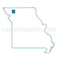
Outline

Summary
| Unique Area Identifier | 607859 |
| Name | Athens South Voting District |
| County | Gentry County |
| State | Missouri |
| Area (square miles) | 44.24 |
| Land Area (square miles) | 44.16 |
| Water Area (square miles) | 0.08 |
| % of Land Area | 99.83 |
| % of Water Area | 0.17 |
| Latitude of the Internal Point | 40.20678280 |
| Longtitude of the Internal Point | -94.30936530 |
Maps


Graphs
Select a template below for downloading or customizing gragh for Athens South Voting District, Gentry County, Missouri


Neighbors
Neighoring Voting District (by Name) Neighboring Voting District on the Map
- Athens North Voting District, Gentry County, MO
- Darlington Voting District, Gentry County, MO
- Huggins/Carmack Voting District, Gentry County, MO
- Miller/Berlin Voting District, Gentry County, MO
- Miller/McFall Voting District, Gentry County, MO
- New Hampton Voting District, Harrison County, MO
Top 10 Neighboring County Subdivision (by Population) Neighboring County Subdivision on the Map
- Athens township, Gentry County, MO (2,178)
- Cooper township, Gentry County, MO (1,859)
- White Oak township, Harrison County, MO (529)
- Miller township, Gentry County, MO (432)
- Huggins township, Gentry County, MO (146)
- Butler township, Harrison County, MO (139)
Top 10 Neighboring Place (by Population) Neighboring Place on the Map
Top 10 Neighboring Unified School District (by Population) Neighboring Unified School District on the Map
- South Harrison School District, MO (5,688)
- Albany R-III School District, MO (2,851)
- Pattonsburg R-II School District, MO (1,103)